|
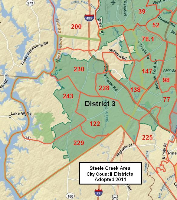
ELECTION DISTRICTS IN STEELE CREEK Beginning with the November 2011 elections, voters nationwide have been electing representatives to various bodies using new election districts delineated based on 2010 census counts. Redistricting is necessary after each census to ensure that each district contains approximately the same number of residents. Maps below show districts in the Steele Creek area for the following bodies:
On the maps below, election precinct boundaries and numbers are shown in red and Steele Creek is outlined in green. The Charlotte City Council adopted new districts at its meeting on June 13, 2011. These districts were used for the November 2011 municipal election. All of Steele Creek within the Charlotte city limits is within City Council District 3. (Boundaries continue to expand slightly due to small annexations since 2011.)
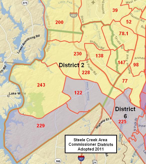
On July 28, 2011 the North Carolina General Assembly passed House Bill 719, which establishes new districts for the Mecklenburg Board of County Commissioners. They were used for the 2012 elections.
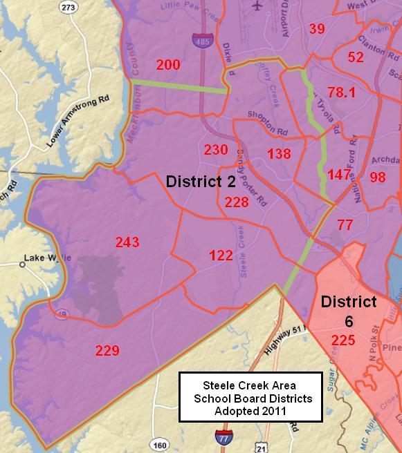
Charlotte-Mecklenburg Board of Education The Charlotte-Mecklenburg Board of Education adopted new districts at its meeting on September 27, 2011. All of Steele Creek is in Board of Education District 2. School Board district and at-large representatives are elected every two years on a rotating schedule. All members serve four-year terms. The six district representatives were chosen in the November 2013 election and will be up for election again in November 2017. Representatives for the three at large seats were chosen in the November 2015 election and will be up for election again in November 2019.
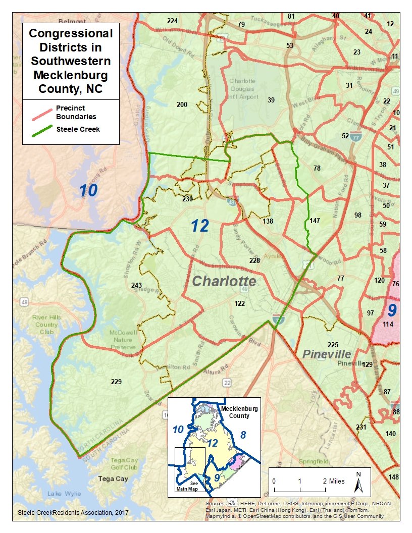
The General Assembly adopted new congressional districts on February 19, 2016, replacing those previously adopted on July 28, 2011.
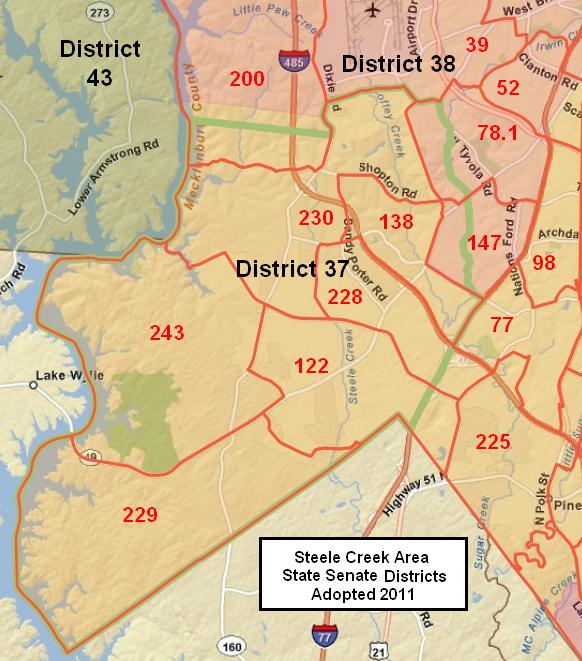
The General Assembly adopted new state senate districts on July 27, 2011.
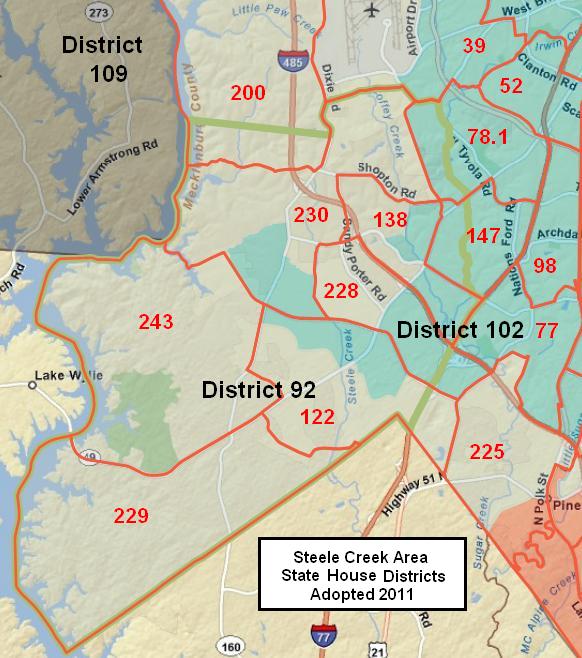
North Carolina House of Representatives The General Assembly adopted new state house districts on July 28, 2011.
|